Navigating the Skies: The B-52's Astro Compass and Angle Computer
AI Summary
Before the advent of GPS, aircraft relied on celestial navigation, a method that uses the positions of stars, planets, and the sun to determine location. This technique, while highly accurate and immune to jamming, was complex and labor-intensive when done manually. In the early 1960s, the B-52 bomber was equipped with an automated system that utilized an electromechanical analog computer known as the Angle Computer to perform these calculations.
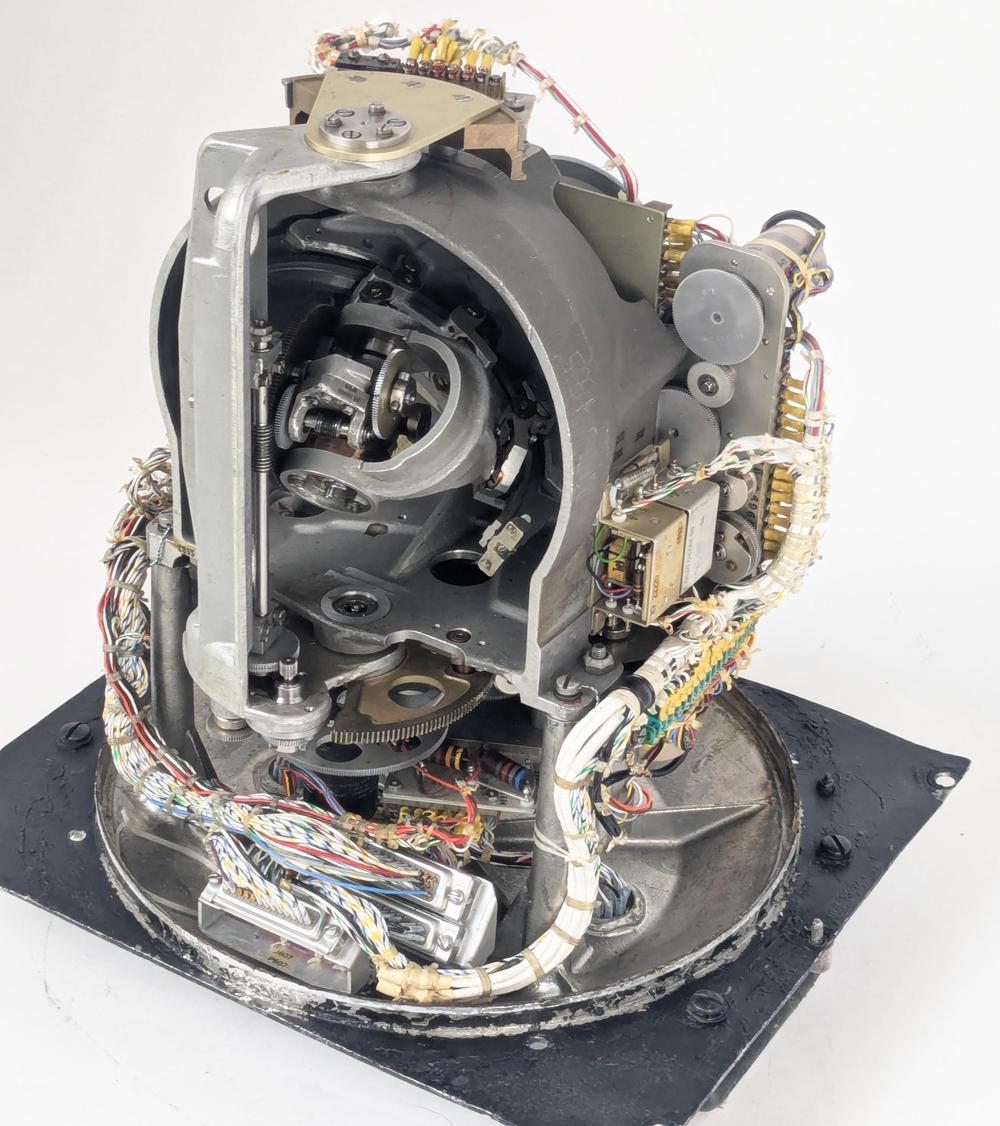
The Angle Computer was a marvel of its time, designed to solve the navigational triangle mechanically. It modeled the celestial sphere physically, using a star pointer to translate celestial coordinates into azimuth and altitude, which were then used for navigation. This system was part of the larger Astro Compass, which provided precise heading information and could determine the aircraft's position using the 'lines of position' technique.
The Astro Tracker, a key component of the Astro Compass, was mounted on the aircraft and used a photomultiplier tube to detect starlight. It maintained a stable platform through a gyroscope and motors, aiming the telescope at specific stars. The system was complex, consisting of 19 components, including the Angle Computer, control panels, and amplifiers.
Navigators used the Master Control Panel to input data such as time and star coordinates, which were displayed on analog dials. The necessary celestial data was sourced from the Air Almanac, a publication providing star positions at regular intervals. The Astro Compass converted these global coordinates into local ones using spherical trigonometry and the navigational triangle.
The Angle Computer's mechanical design included a half-sphere model of the celestial sphere, with gears and motors positioning the star pointer. This mechanism allowed for the conversion of celestial coordinates into azimuth and altitude, essential for navigation. Electrical components like synchro transmitters provided outputs for these calculations.
The system also enabled the determination of the aircraft's location through the celestial line of position. By measuring the altitude of a star and comparing it to expected values, navigators could draw lines of position on a map, intersecting these lines to pinpoint their location.
Despite its complexity, the Angle Computer represented the cutting edge of navigation technology before digital computers became viable. It combined mechanical, electrical, and electronic elements to solve navigation problems, a testament to the ingenuity of its designers. As digital technology advanced, systems like the Astro Compass became obsolete, but they remain a fascinating chapter in the history of navigation technology.
Key Concepts
A method of navigation that uses the positions of celestial bodies like stars, planets, and the sun to determine a location on Earth. It involves complex calculations and requires precise measurements.
A spherical triangle used in celestial navigation to convert global star coordinates into local coordinates. It involves complex trigonometric calculations to determine azimuth and altitude.
Category
TechnologyMore on Discover
Summarized by Mente
Save any article, video, or tweet. AI summarizes it, finds connections, and creates your to-do list.
Start free, no credit card